Category: Hall of Shame

  • August 7th: 400ft Joyride Over Mishaum Point Road

    August 7th: 400ft Joyride Over Mishaum Point Road

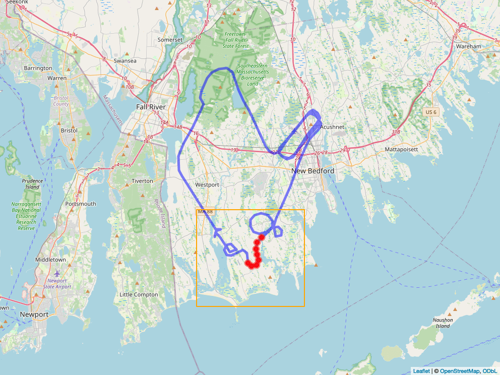
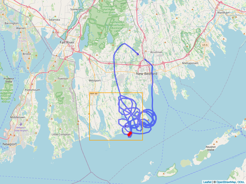
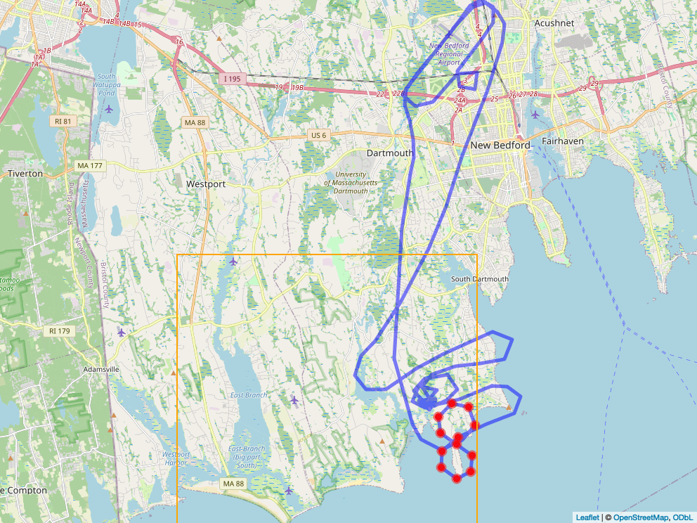
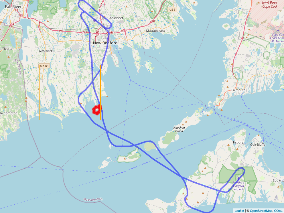
    Today, the Cessna N760BW, operated by BSU flight school, was documented flying as low as 400 feet above ground level over residential homes along Mishaum Point Road on its way out to Martha’s Vineyard.

    View the flight track here: https://www.flightradar24.com/data/aircraft/n760bw#3ba0699b

    Why this matters:

    • Mishaum Point Road is a residential area where families live, walk, and gather.
    • Flying at 400 feet AGL over neighborhoods and public trail areas is not just a disturbance—it directly violates legal safety standards intended to protect our community.
  • August 4th: BSU Aircraft Takes 400ft Tour of Horseneck Rd

    August 4th: BSU Aircraft Takes 400ft Tour of Horseneck Rd

    Today, a small training aircraft — N721SA (BSU again)— flew dangerously low over Horseneck Road, getting down to just 400 feet above the ground. That’s well below what the FAA (Federal Aviation Administration) says is safe for flying over neighborhoods like ours.

    View the flight track here: https://www.flightradar24.com/data/aircraft/n721sa#3b93e3ec

    Why This Matters

    • It’s dangerous. At that low height, pilots have almost no time to react if something goes wrong.
    • It’s disruptive. These flights are loud, unsettling, and shake up our peaceful neighborhoods.
    • It’s happening too often. This isn’t the first time — low flights are becoming a regular issue in Dartmouth and Westport.
  • July 21st: BSU Aircraft plummets to only 400ft above Barney’s Joy

    July 21st: BSU Aircraft plummets to only 400ft above Barney’s Joy

    Residents report that today, a Cessna 172R registered as N715BW — linked to Bridgewater State University — descended to just 400 feet above ground level over the Barney’s Joy area, a clearly populated zone. This altitude is well below the 1,000-foot minimum required by FAA regulation 14 CFR §91.119(b) when flying over congregated or developed areas.

    See the track here: https://www.flightradar24.com/data/aircraft/n715bw#3b5b7f72

    Why this matters:

    • A mere 400 feet AGL is dangerously low, especially over homes, open gathering spots, and local roads.
    • This isn’t a momentary glitch—it adds to a growing pattern of unsafe, low-altitude flights over Dartmouth and Westport, where people live, work, and recreate.
    • FAA rules are clear: flights over populated areas must stay at least 1,000 feet above the highest obstruction within 2,000 feet.

    Such reckless operation not only violates federal safety standards—it places individuals and property in harm’s way. Residents expect accountability and strict enforcement of these safety regulations.

  • 27th June: Dangerously low figure 8 over Mishaum Point

    27th June: Dangerously low figure 8 over Mishaum Point

    Today, a Cessna 172 N780SA — connected with BSU — was documented flying at a dangerously low altitude of only 600 feet above Mishaum Point. That’s well below the 1,000‑foot minimum required when flying over populated or developed areas – guess they didn’t see the houses there…

    To add to the concern, the aircraft made several low passes over Round Hill Beach, a regularly crowded public area. This isn’t just unsettling—it’s against FAA safety rules.

    Flight track: https://www.flightradar24.com/data/aircraft/n780sa#3aff534b

    Why this matters:

    • FAA Regulation 14 CFR § 91.119(b) requires aircraft to maintain at least 1,000 feet above the highest obstacle within a 2,000-foot horizontal radius when flying over populated areas such as towns, beaches, or neighborhoods.
    • Flying at 600 feet over Mishaum Point or buzzing Round Hill Beach is not only disruptive; it is a clear violation of federal safety standards.